Printing from Parcel Finder
How to print your own map from the Scott County Parcel FinderIntroduction
You’re looking at an area on the Scott County Parcel Finder and would like to have a static or hard copy version. What do you do? In this little tutorial we’ll walk through how to get your map set up for printing and then how to actually get it printed.
Set up your map
- Navigate to the Scott County Parcel Finder. The URL for this app is a little crazy so you might want to just bookmark it for later reference.
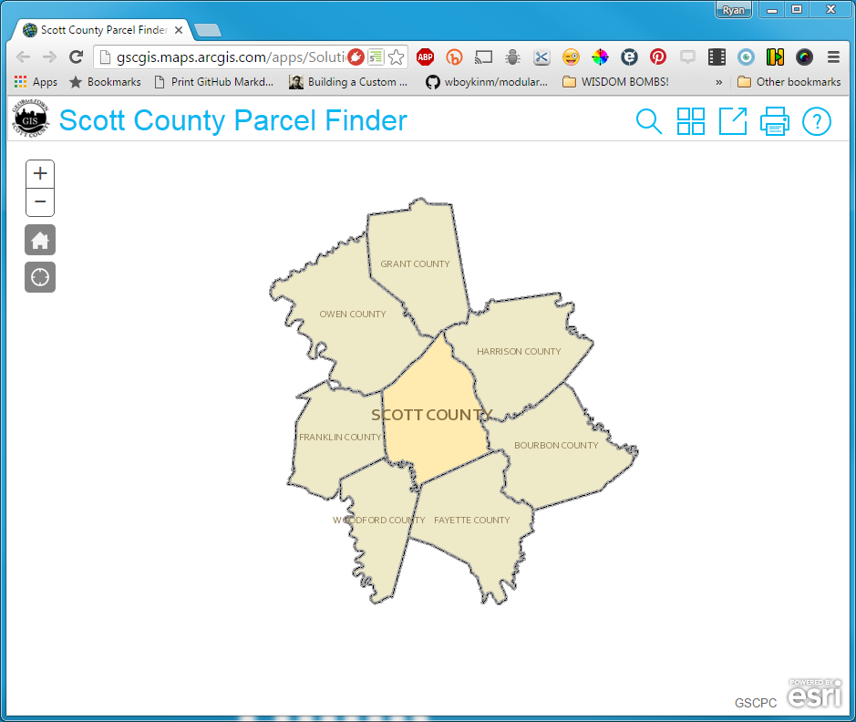
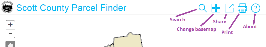
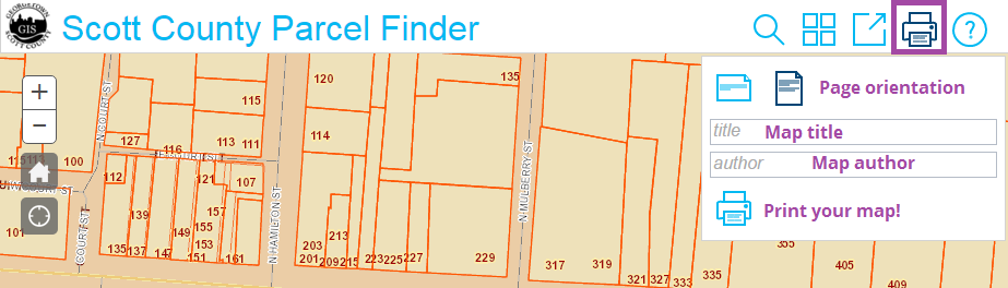
Map URL: http://gscgis.maps.arcgis.com/apps/Solutions/s2.html?appid=8062c4ef303049c3af50036ddab3c8c7 - Take a look at the bar along the top, focusing on the icons on the right side. These icons are actually buttons that help you tap extra functionality in the map. From left to right, these buttons let you search for a parcel, change the basemap, share the map (email, Facebook, or Twitter), print the current map view, and read a little more information about the map itself.
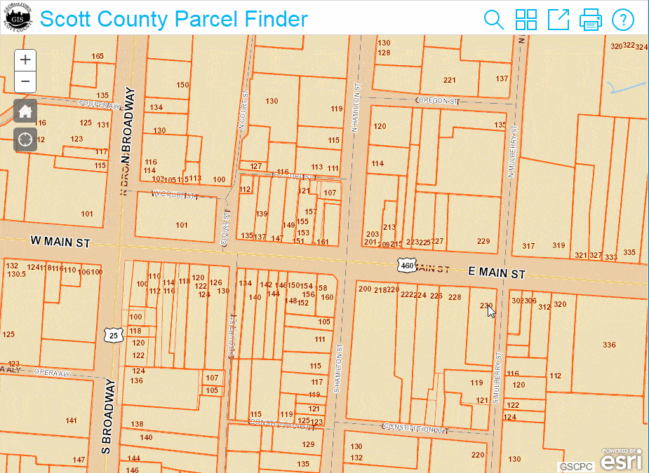
- Let’s say we have an address for which we want to print a map. We can use the search tool to zoom to that location. In this case we’ll use
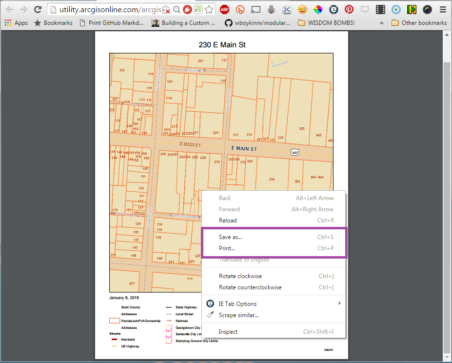
230 E Main Stin Georgetown. Click the Search icon. A little window will open up with a text field. Type the address into the text field. You’ll notice as you type that search tool will present you with possible matches to what you’re typing. When you see a result you’re pleased with, click it.
- Using your mouse, adjust the map to your preference. You can left-click + drag to move the map around. Use your scroll wheel or +/- buttons in the top-left corner of the map to zoom in and out. You’ll want to make sure the most important part of the map is in the center of the screen as the dimensions of the printed map are preset and may not match the dimensions of your browser window. In the case of our example, we’ll left-click and drag 230 E Main St to the center of the browser window and zoom in a little.
Print your map
- Click on the print icon in the top bar of the map. This will open a little window that gives you options for page orientation, title, author, and the command to print.
- Select your orientation preference (landscape or portrait). If you want, type in a title and author. These fields are optional but it is a good practice to include this information so you and others know what the focus of the map is and who created it. For our example, we’ll produce a
portraitoriented map entitled230 E Main Stand authored byGSCPC.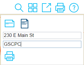
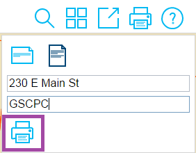
- Take a final look at your map. If it looks good, click the print icon within the little print window.
- What you may be expecting is a window associated with your printer to open. This is not be the case. Instead, a new window or tab should open up in your browser. In it is a PDF version of your map. Congrats! You’ve successfully generated a static map from the Parcel Finder!
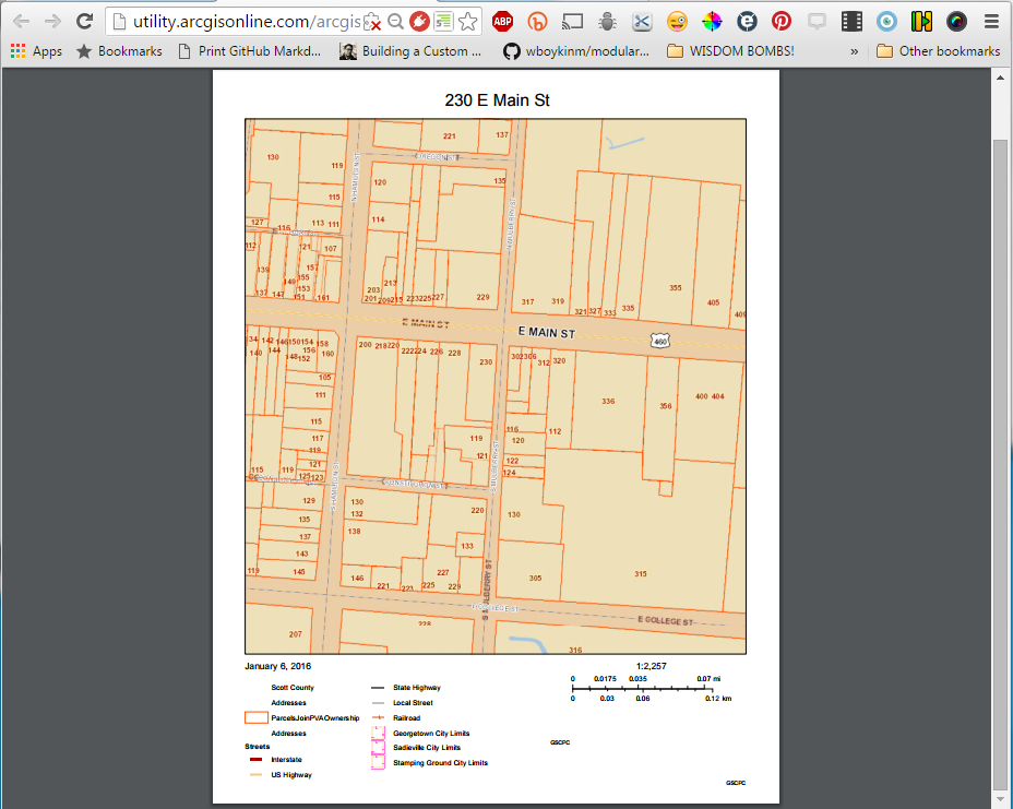
- Now you probably want to save the PDF map to your computer and/or print it out on a piece of 8.5” x 11” paper. Depending on your browser you may have some buttons available that allow you to print and save. If you don’t see them, you should be able to access print and save functionality by right-clicking the PDF map. A menu should pop up with options to Save and/or Save as… as well as Print….
Conclusion
In this tutorial we looked at how to set up and create a printable PDF map from the Scott County Parcel Finder using the print options within the app itself. If you have any questions or corrections, feel free to let us know!